Bike Angel Fire and Taos
Overview
Angel Fire and Taos mountain biking landscape offers an adventure of a lifetime. Home to rugged mountains and scenic valleys and famous for its mountain bike terrain its blend of history is unique to this part of the world; a history of Ute Indians, miners, ranchers and Spanish influences with Angel Fire getting its name from the native American Indians for its fiery lights on the mountain peaks. Northern New Mexico’s landscape includes 13th century Pueblo dwellings, sheer-walled canyons, singletrack trails, lonely forests, meandering amongst its highest mountain rising to 13,161 feet. New Mexico is a place of strong Native American and Spanish influences with a colourful history as exciting as its mountain bike trails to test and excited all two-wheeled enthusiasts.
Angel Fire sits at almost 3,000 metres and Taos down at 2,000 metres, so you’ll get a variety of full on mountain biking experiences featuring long rides, big climbs and big descents. Angel Fire Bike Park opened in 2001 and offers 96km of trails and purpose-built, lift-served mountain bike terrain.
Angel Fire and Taos Top Rides
South Boundary Trail
A challenging singletrack climb.
Distance: 2.4km | Ascent: 263m | Trail Grade: Blue
Northside Alpine Wildflower loop (Taos)
Surrounded by wildnerness this high alpine terrain incorporates old mining roads with mountain singletrack. Some terrain is steep leading to exciting downhills. Trail offers lots of different routes from easier shorter loops to longer rides.
Distance: 16.5km | Ascent: 664m | Trail Type: 60% singletrack | Trail Grade: Blue/ Blue Black / some Double Black Diamond
Elliot Barker Loop
This challenging route starts and ends in Angel Fire. Expect long ascents and graceful descents.
Distance: 27.3km | Ascent: 630m | Trail Grade: Blue/Black Diamond
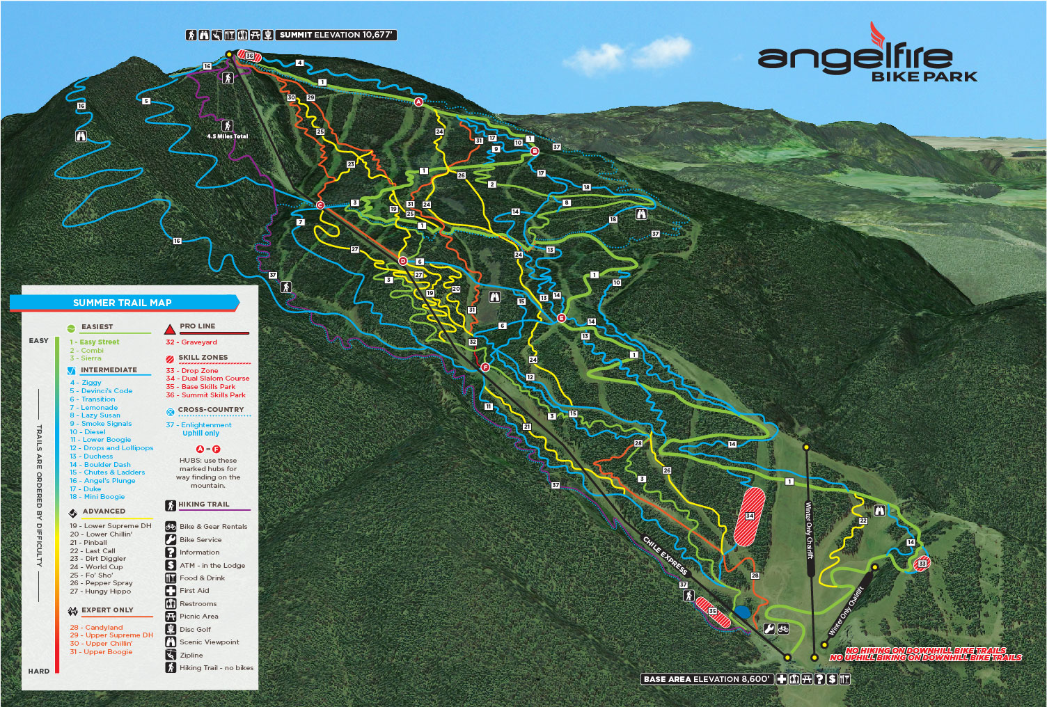
Angel Fire and Taos Trail Map
Angel Fire Bike Park Trail Map
Getting There
Angel Fire and Taos are located in southwestern Colfax County, New Mexico.
- Fly into Albuquerque Airport and we can arrange a shuttle to the resort – approximately 2.5 hours
- Fly into Denver Airport and we can arrange a shuttle to the resort – approximately 4 hours
Accommodation
Angel Fire and Taos has a variety of accommodation options to choose from.
Contact our Active Travel Experts for insider tips on where to stay and tailor-made bike experiences.